


Franson Voting District, Ferry County, Washington
About
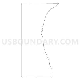
Outline
Summary
| Unique Area Identifier | 684159 |
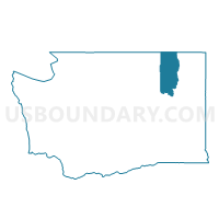
| Name | Franson Voting District |
| County | Ferry County |
| State | Washington |
| Area (square miles) | 8.55 |
| Land Area (square miles) | 8.55 |
| Water Area (square miles) | 0.00 |
| % of Land Area | 100.00 |
| % of Water Area | 0.00 |
| Latitude of the Internal Point | 48.86351780 |
| Longtitude of the Internal Point | -118.61771730 |
Maps

Graphs
Select a template below for downloading or customizing gragh for Franson Voting District, Ferry County, Washington


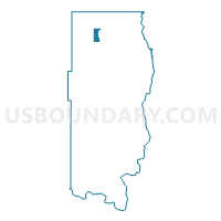
Neighbors
Neighoring Voting District (by Name) Neighboring Voting District on the Map
- Boulder Voting District, Ferry County, WA
- Danville Voting District, Ferry County, WA
- Lone Ranch Voting District, Ferry County, WA
- Malo Voting District, Ferry County, WA
- St Peters Creek Voting District, Ferry County, WA
- Toroda Voting District, Ferry County, WA
- Vulcan Voting District, Ferry County, WA